Skip to content
The 19th-century explorer John Wesley Powell predicted that the lack of water would cause problems in the western United States, and he recommended that state lines be drawn according to watersheds instead of according to other political boundaries. He believed this would encourage residents to conserve water instead of fighting over it. He drew a map of the West that suggested what those states could look like. John Lavey of the Sonoran Institute has drawn a national map that follows on the states-by-watershed idea. Click to see a larger version, or go to http://www.flickr.com/photos/108072018@N03/10929250216/.

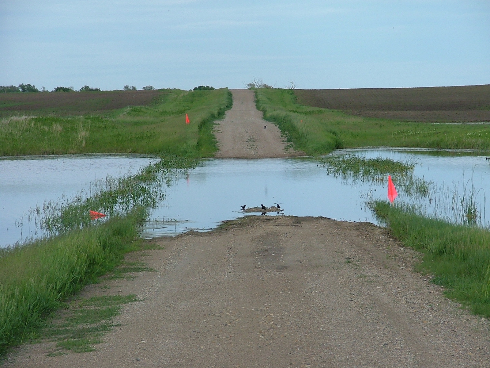
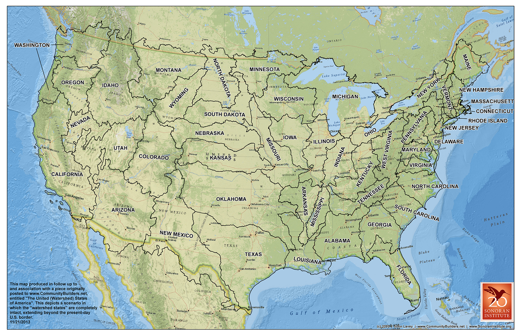
Water flows across political boundaries, brings conflict with it

The 19th-century explorer John Wesley Powell envisioned developing the political boundaries of the arid American West based on watersheds. More than 120 years ago, he predicted the potential for fights over water. Powell’s watershed boundary vision did not come to pass, but the conflicts he envisioned did—including here in the Dakotas.

Watershed taskforce agrees relief is needed in Day County

A Regional Watershed Advisory Task Force, a legislative committee charged with studying water management issues, held its third meeting in Webster last week where the message from landowners was relief from the ever rising sloughs and lakes.

Trees are salvaged from flooding

With more and more trees from across the county going under water, three local men have decided to put that timber to use