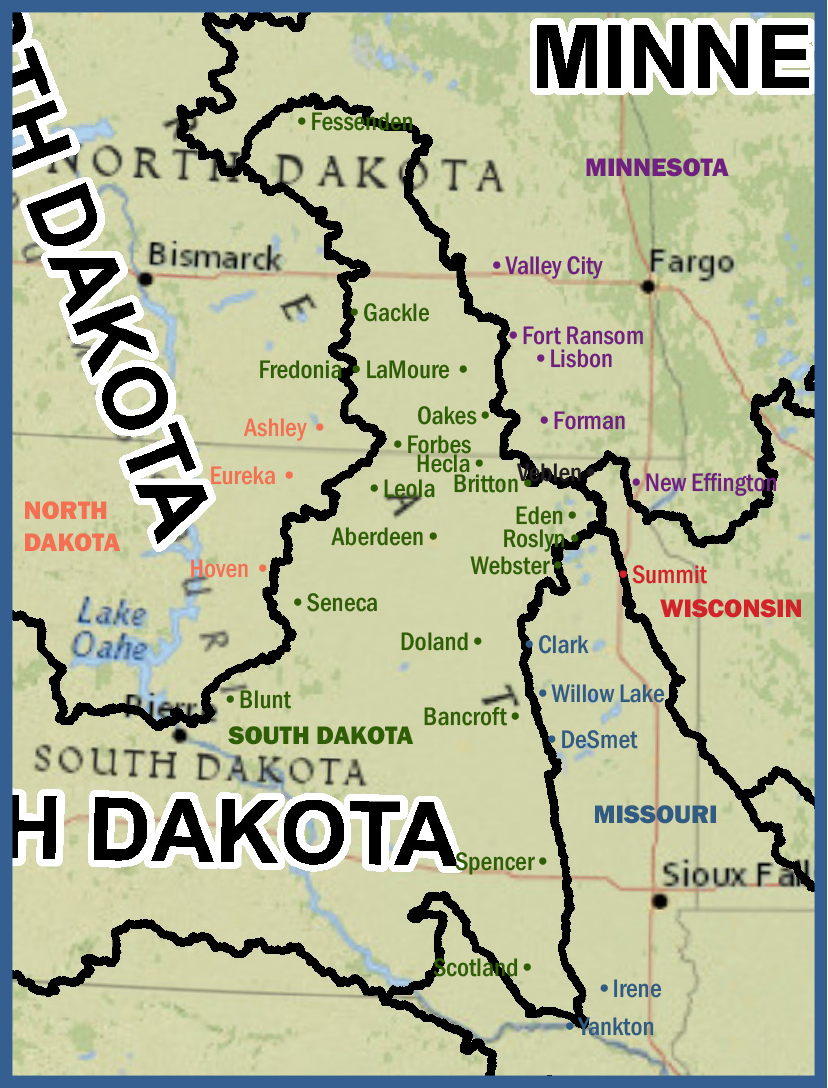
This is a close-up look at the James River Watershed, and what states some of the towns in the region might belong to if borders had been drawn as Powell envisioned. (The border is a bit difficult to eyeball, so some border communities might actually fall across the line. If you know where to draw the watershed boundaries in your backyard, you might be able to draw a more accurate conclusion about your state allegiances in the United Watershed States of America.) See the full map: http://www.flickr.com/photos/108072018@N03/10929250216/
watershedstates-JRV
By Heidi Marttila-Losure
January 3, 2014
This is a close-up look at the James River Watershed, and what states some of the towns in the region might belong to if borders had been drawn as Powell envisioned. (The border is a bit difficult to eyeball, so some border communities might actually fall across the line. If you know where to draw the watershed boundaries in your backyard, you might be able to draw a more accurate conclusion about your state allegiances in the United Watershed States of America.) See the full map: http://www.flickr.com/photos/108072018@N03/10929250216/
2014-01-03