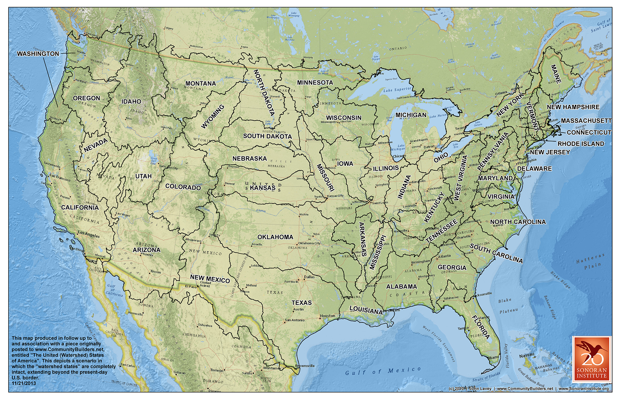
The 19th-century explorer John Wesley Powell predicted that the lack of water would cause problems in the western United States, and he recommended that state lines be drawn according to watersheds instead of according to other political boundaries. He believed this would encourage residents to conserve water instead of fighting over it. He drew a map of the West that suggested what those states could look like. John Lavey of the Sonoran Institute has drawn a national map that follows on the states-by-watershed idea. Click to see a larger version, or go to http://www.flickr.com/photos/108072018@N03/10929250216/.
watershedmap
By Heidi Marttila-Losure
January 3, 2014
The 19th-century explorer John Wesley Powell predicted that the lack of water would cause problems in the western United States, and he recommended that state lines be drawn according to watersheds instead of according to other political boundaries. He believed this would encourage residents to conserve water instead of fighting over it. He drew a map of the West that suggested what those states could look like. John Lavey of the Sonoran Institute has drawn a national map that follows on the states-by-watershed idea. Click to see a larger version, or go to http://www.flickr.com/photos/108072018@N03/10929250216/.
2014-01-03